Latest news about Bitcoin and all cryptocurrencies. Your daily crypto news habit.
written by :- Agraha Jigyasu
Reliable data on economic livelihoods remain scarce in the developing world, hampering efforts to study these outcomes and to design policies that improve them. Although the quantity and quality of economic data available in developing countries have improved in recent years, data on key measures of economic development are still lacking for much of the developing world . This data gap is hampering efforts to identify and understand variation in these outcomes and to target intervention effectively to areas of greatest need.
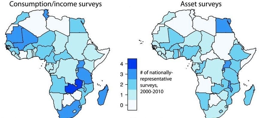
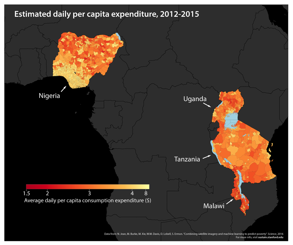
According to World Bank data, during the years 2000 to 2010, 39 of 59 African countries conducted fewer than two surveys from which nationally representative poverty measures could be constructed. Of these countries, 14 conducted no such surveys during this period, and most of the data from conducted surveys are not in the public domain. However a new research eliminates the need of passive surveys by sending out officials to reach each and every home for collecting information instead it uses the power of computer vision and machine learning to achieve the same. Using daytime and night light satellite imagery, fine-grained poverty and wealth estimates can be made. Such estimates can prove very useful in creating region centric development policies so that maximum benefit transfer can take place.
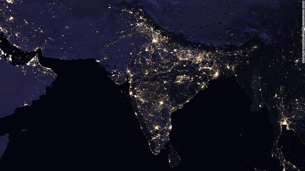
Night light satellite imagery proved to be very useful in extracting economic information about a locality as the more lightning directly corresponds to economic wellness.
 Economically advanced places in India have greater night light density
However prediction using night light imagery is not always correct as places with less population density seem to have less night light density but at the same time may not be economically backward. Ex:- the farmhouses. To solve this problem the scientists thought of introducing daylight imagery to the model, the daylight imagery solved the problem as density of houses and their size can be easily seen in them.
This method of poverty analysis is highly efficient and cost effective. But it also have some limitations. Every part of the world has its own culture and living style and hence model trained on one part of the world does not work effectively on any other part. Therefore we first need to train our model on a balanced data-set from the some region to make highly precise predictions about other places having the same living style. Such analysis are surely going to help the world to develop and ensure the equal distribution of wealth.
Follow NITWTechnoreview on Twitter and Facebook
Poverty analysis using satellite imagery and machine learning was originally published in Hacker Noon on Medium, where people are continuing the conversation by highlighting and responding to this story.
Disclaimer
The views and opinions expressed in this article are solely those of the authors and do not reflect the views of Bitcoin Insider. Every investment and trading move involves risk - this is especially true for cryptocurrencies given their volatility. We strongly advise our readers to conduct their own research when making a decision.


